Researchers of the Geomorphology and Active Tectonics (GEAR) Laboratory at UP NIGS conducted field activities in Northern Luzon from 01 to 06 October 2026, as part of the DOST funded project “Seismic Hazard Assessment and Paleoseismology and Earthquake Sources in Northern Luzon, Philippines (SHAPES)”. The project aims to evaluate the seismic hazard in Northern Luzon through detailed geomorphological surveys of active faults, creation of a comprehensive database of fault parameters, and modeling of site-specific seismic hazard assessment scenarios.
A team of researchers conducted geomorphological fieldwork in Ilocos Norte and Ilocos Sur to validate mapped morphotectonic features (e.g., fault scarps, offset streams) related to the Vigan–Aggao Fault. A separate team also conducted Refraction Microtremor (ReMi) surveys in Bangued, Abra to collect shear-wave velocity data to create site-specific seismic hazard models for major municipalities and cities.
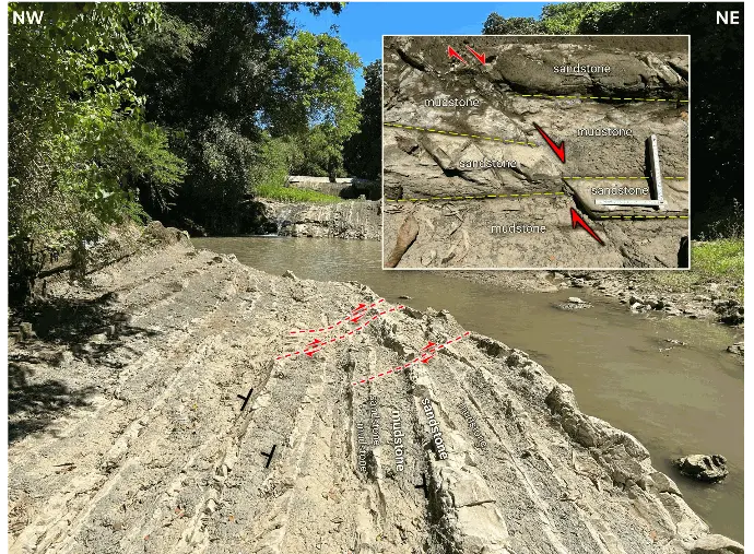
Steeply dipping sandstone and mudstone beds (N45°E, 68°NW) along a river in Brgy. Buanga, Pinili, Ilocos Norte (WGS84: N17°57'43.4", E120°33'41.9"). Inset: Close-up view of the sandstone and mudstone beds offset by more than 10 cm. The fault strikes N85°E and dips 80°NW.
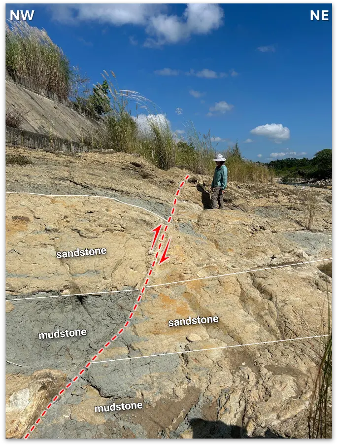
Sandstone and mudstone beds (N55°E, 56°NW) offset by more than 40 cm along a river outcrop in Brgy. Maas-asin, Magsingal, Ilocos Sur (WGS84: N17°41'35.7", E120°28'01.2"). The fault strikes N2°W and dips 70°SW.
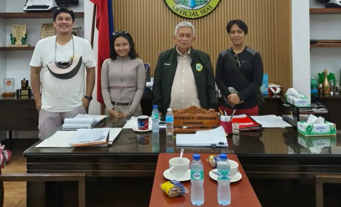
Project staff (Danaxiane Marpuri, Regie Cortez, Hazel Andrea Vidal) made a courtesy visit to Gov. Eustaquio P. Bersamin of the Provincial Government of Abra.
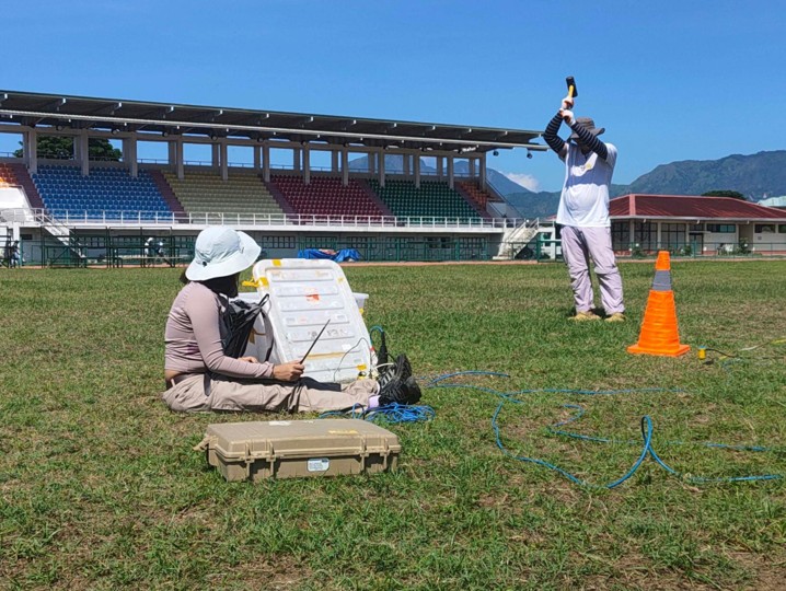
SHAPES project staff conducting a refraction microtremor survey in the Abra Sports Complex, Bangued, Abra.